Permapyrenees (EFA 063/01), an Interreg POCTEFA project co-financed by the European Union
The Pyrenees are the mountain chain in southern Europe where the cryosphere plays a crucial role in hydrological, geomorphological and environmental processes. The components of the cryosphere (snow, glaciers and permafrost) serve as robust indicators of climate change and are at the same time perceptible to society. The recent climate change has caused a reduction in the snow cover and the imminent disappearance of the Pyrenean glaciers; all this is being monitored through different transpyrene projects and initiatives.
However, even today very little is known about permafrost (permanently frozen ground), beyond its existence in the highest areas of the mountain range (>2,600 m). Even less is known about its recent dynamics and how it may respond to projected thermal increase in the future.

Permapyrenees (EFA 063/01) is a 3-year Interreg POCTEFA project (01/01/2024 – 01/01/2027) and Co-financed by the European Union that is based on the study of permafrost, and will generate new indicators for monitoring climate change. This project will also serve to monitor and prevent risks arising from the degradation of permafrost (e.g. instability of slopes or rockfalls), which in recent years have affected heavily frequented mountain routes and some infrastructures.
For this, a series of new monitoring techniques and a series of deep drilling will be used to detect the presence of permafrost and the risks associated with its existence. In addition, the precise information generated in this project will be shared with the managing agents of the territory as well as with the general population in order to practice and enjoy the mountain more safely.
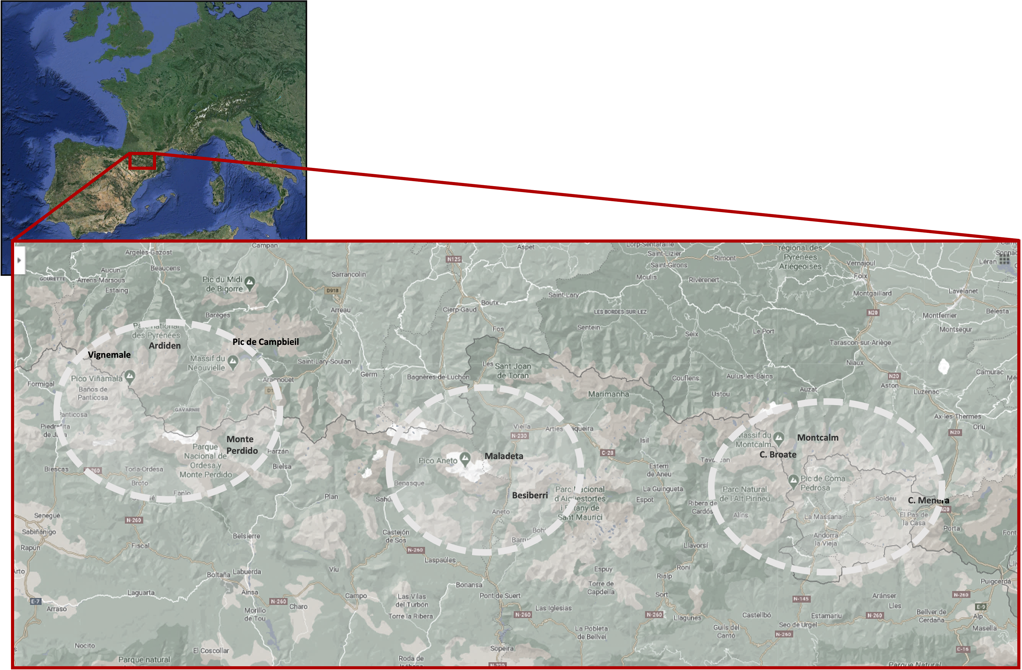
These drillings will be carried out in the following areas:
1. Besiberri (GR Besiberri N 2600m)
2. Circ de Pessons (GR Clot de la Menera 2492m)
3. Vignemale (Col de la Cerbillona 3198m)
4. Ardiden (GR Ardiden – Lac Grand 2460m)
5. Monte Perdido ( Pic Marboré 3251m)
6. Pica d’Estats (GR Clot de Broate 2800m)
7. Pica d’Estats (Montcalm 3078m)
8. Maladeta (Pico de Coronas 3297m)

Project partners
The project collaborators are Andorra Recerca Innovación; Center for Studies and Expertise on Risks, the Environment, Mobility and Urban Planning (CEREMA); Telecommunications Technological Center of Catalonia (CTTC); Pyrenean Institute of Ecology (IPE-CSIC); Kilian Jornet Foundation (KJF); University of Barcelona (UB); University of Perpignan Via Domitia (UPVD).
And as associates the following entities; Environnements, Dynamiques et Territoires de Montagne (EDYTEM); High Mountain Physical Geography Research Group (GFAM); Ordesa – Viñamala Biosphere Reserve; PANGEA; National Park of Aigües Tortes and Estany de Sant Maurici; Natural Park of the High Pyrenees; Meteorological Service of Catalonia.


“The PERMAPYRENEES project has been co-financed at 65% by the European Union through the Program Interreg VI-A Spain-France-Andorra (POCTEFA 2021-2027). The objective of POCTEFA is strengthen the economic and social integration of the Spain-France-Andorra border area”